It's T-minus 12 days until the Ragnar Great River Relay and our team, Masochists in Motion, has been living up to its name: members Greg and Pam have been leveled with injuries and, speaking only for myself, I'm gimping my way toward the start line. In spite of being completely and totally bummed by the absence of these two wonderful people, I'm hopeful Ragnar will still be a memorable experience and that we'll be together on another relay in 2013.
That said, the "injury" to my right knee in Phoenix two weeks ago turned out to be an easy fix, thankfully. After visiting my family doctor, he sent me to my chiropractor before ordering a bunch of x-rays. The next day, my wonderful chiro discovered the right hip was not only way out of whack, but made my right leg a half inch shorter then the other. He suspects it's been out awhile. Grrr. So I've been slowly moving toward longer distances with today's 16 mile tour around Wisconsin's Moose Lake "in the heart of the Chequamegon National Forest" where my brother- and sister-in-law's quintessential lake cabin served as a breathtaking backdrop to a lovely, drawn out jaunt.

The boat access at the end of Moose Lake Club Road.
In the event the knee failed me, I opted to cover the area closest to the
cabin first and headed away from Moose Lake via Moose Lake Club Road
and then south along Pine Point Road. Taking the short, but steep hill of
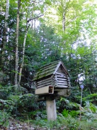
Whaley Drive, I was soon enjoying the coast downward past fun,
kitschy signs and mailboxes such as this.

Coming off Whaley Drive and back onto Pine Point Road, I was able
to catch mist riding off Moose Lake.

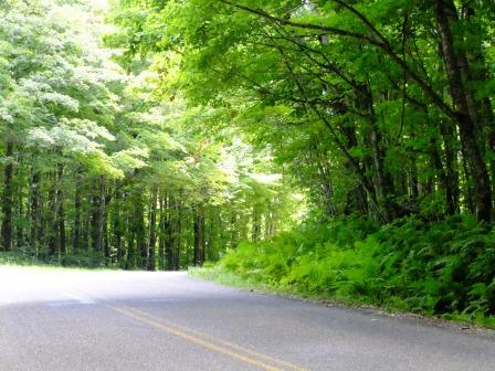
Pine Point Road heading away from Moose Lake. This soft, steady incline
was much more forgiving then some of the climbs that lie ahead.

Isn't a morning moon referred to as a Children's Moon?

Pretty flora along Wolf Island Road.

Is anyone else worried about the bee population? I'm happy to document
that bees seem quite active up here in Wisconsin's North Woods.

The fork in Wolf Island Road. The road circles the outer rim of the island
where numerous cabins and homes enjoy lakefront views.

When you turn onto Wolf Island Road, it offers a delicious dive down toward
the island. But coming back up is another story. I approached it as I do
Davenport's Brady Street: slow and easy.

After reaching the summit of Wolf Island Road and coming back onto
Pine Point, I enjoyed another descent and turned left onto Fin & Feather.
As with much of the roads off the main artery of Pine Point, Fin & Feather
is a dead end with cabin lanes dotting the edges. After a Saturday of rain,
others were eager to be outdoors and I met some happy cyclists
enjoying the out-and-back nature of Fin & Feather.

While much of the Midwest has been drought stricken, northern Wisconsin
has enjoyed regular rainfall as evidenced by the lush forest floor
and backwater areas of Moose Lake.

More backwater coves off Fin & Feather.

From the Pine Point Road bridge spanning the northeast "antler" of
Moose Lake. A view to the east where Moose Lake is fed by the
West Fork Chippewa River.

The west view from the bridge: the west antler of Moose Lake.

More bright flora along Pine Point Road.

Self portrait.

The head of Pine Point Road off Hwy. S.

Flora along Hwy. S.

More color amid the green . . .

Along Teal River, a small, northern trickle from the West Fork
Chippewa River, was this corn plant!

This is what I love about running. I'm not burdened with my bike or car,
keeping me from getting close to these views!

Teal River flowing toward West Fork Chippewa from Hwy. S.

Lovely lily pads.

The innocence of a deserted little dock off the backside of a cabin near Hwy. S.

I love silly stuff like this!

An historical marker off Hwy. S as Moose Lake Road crosses
West Fork Chippewa River. The bridge was recently rebuilt
(and done so BEAUTIFULLY) and this marker was surrounded
by beautiful foliage and a bench. As I was approaching, a couple
on a tandem bike was leaving. I think the marker is visited frequently.

Gorgeous glads . . .

The depth of color slayed me!

This was a bench near the historical marker, looking out on the river.

The south view of West Fork Chippewa from Moose Lake Road.

Louie's Landing Road veers off Moose Lake Road.

My sister-in-law had told me elk have been spotted in the area! Unfortunately
luck was not with me. Despite hearing of sightings, neither elk nor bear
wandered before my lens.

As Louie's Landing Road drops down to its namesake,
Moose Lake pops from the cover.

The day before on Saturday Aug. 5 was the annual Moose Lake Festival.

The mailbox at Louie's Landing.

I may not be a drinker anymore, but I still appreciate "Hamm's"!

After gaining a few cell phone bars and calling Hubs to tell him not to worry,
I continued along Louie's Landing Road to the bridge at Muskie Rapids.
Again, another example of the freedom to go "off road."

This photo was actually snapped AFTER the next one, but I wanted to provide
better context. This recently rebuilt bridge serves to help control the water
level of Moose Lake as it spills into Muskie Rapids.

Here's the view from the bottom.

The pine-y splendor of the growth along Louie's Landing Road.

Heavenly . . .

While I love my road bike, I can predict a time in the future
when I may crave a mountain bike so the kids and I can
find out just how awesome the trails around the lake are.
I left Louie's Landing Road and headed back toward the
cabin along Pine Point Road where one of several rec
trails cross the paved Pine Point.

More sweet flora. This I found along the Chippewa River Road
off the north side of Pine Point.

While the clear cutting to enable phone and electrical service
is pretty sad, I have to admit that the swathes leave some
interesting "islands" of trees.

Even the backwater bracken off the Chippewa River Road was lovely!

A trail of pine cones edge the Chippewa River Road
as I head back out toward Pine Point and the cabin.

I'm thinking a tour of mailboxes are in order! This one I spotted along Pine Point
just before crossing the bridge near Fin & Feather Road.

What once goes down must come up and that's the case with Pine Point Road's
return to the cabin as I lumbered up the hill.

Not all is lost when trudging along with your head down!
While doing so, I spotted some lucky charms!!!
Nearing and passing the turn for Wolf Island Road. I never tire of the lush ferns.

Pine Point's gorgeous canopy as it drops toward Moose Lake Club Road.

Ah! Lakeside again!
Loved the Rustic Road sign. 16 miles, way to go. Looking forward to hearing your race report after Relay. Let me know how it goes. I'm in Clinton this and next week, and if you have any desire to get a short run in, let me know.
ReplyDeleteJim - www.AwakeMySole.com
Hey Jim! I heard you were back in town! I'd love to go for a shortie with you! I'll connect on Facebook with you and hopefully we can work something out! Take care and all the best!
Delete